
Walk Norco's Street Directory Parcel by Parcel
A Norco address search is a chain of checks. Start with the situs, the physical place, and use the assessor or county GIS to identify the parcel. The APN bridges deeds and city files when street labels, mailing addresses, or house numbers change. Ownership is a dated record role, not proof that a named person lives at the site.
- Start with address and owner context. Enter the complete address in the Riverside County Assessor property search. Save the APN, situs, and permitted property details.
- Open the parcel view. Use Map My County by address, cross streets, or community. Turn on parcel lines, identify adjacent polygons, and record their APNs.
- Move to the deed index. Search ACR by names, document clues, book/page, or legal description. Keep the grantee, grantor, and recording date with each result.
- Handle voter data correctly. Use My Voter Status for a person's own registration check. A general voter street list is not public; file access has approved purposes.
- Check historical households. At the Corona Heritage Room, use a reverse street section when present. Compare numbers, names, spouses, and occupations without treating a historical listing as current.
Record the source, date, address type, APN, role, and next check. This supports genealogy, house history, civic research, and reconnection while separating land from household evidence.
Norco Street Address Records
Norco records sit with several custodians. GIS shows geography, the assessor property context, the recorder instruments, city departments project files, and the Heritage Room historical listings. Each answers a different question.
| Record Set | Address Key | Custodian | What It Can Show | Access Boundary |
|---|---|---|---|---|
| Parcel and GIS layer | Address, APN, cross streets | Riverside County GIS | Shape, situs, nearby polygons | Free viewer; Parcel Owner is County use only |
| Assessor property record | Address or APN | Riverside County ACR Assessor | Assessed property and tax facts | Public search; owner-name directory not verified |
| Deeds, maps, and liens | Party, document, book/page, APN | ACR Recorder | Parties, instruments, dates, title references | 1975+ path; older work at Gateway; copies ordered |
| Permits and planning files | Address, APN, permit/case | Norco departments | Owner, applicant, contractor, scope, value, inspections | Targeted request; redactions may apply |
| Reverse directories | Street and house number | Corona Heritage Room | Historical names, spouses, occupations, nearby entries | Onsite collection; edition scope varies |
| Voter registration data | Self-check or approved request | California Secretary of State | Own status or limited authorized data | Not a general public street directory |
APN and legal description link address to land. A permit applicant can be a contractor or agent; a mailing address can belong to a trust or distant recipient. A reverse directory reflects one canvass. Together, they make a dated trail, not proof of current occupancy.
Note: Keep each indexed role and event date beside the name.
Norco's Map My County Street Fields
Riverside County's assessor open-data service supplies parcel layers. Map My County adds identify, layers, selection, and reporting. Parcel Owner is County use only, not a public owner-name directory. Save the source and date as GIS applications migrate.
The assessor capture below shows the county source for parcel research.
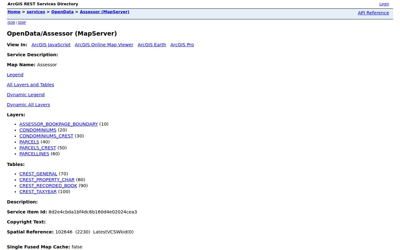
The image identifies a county layer, not occupants. Use the live viewer for parcel and neighboring shapes.
Search Norco Parcels by the Right Field
Map My County offers several paths to one land record. Match the field to the evidence. An address starts, an APN supports repeat work, and a legal description survives subdivision. Cross streets orient but do not identify every parcel.
| Search By | Input Control | Norco Street Use | Result or Limit |
|---|---|---|---|
| Assessor Parcel Number | Text area | Known APN list | Reports selected APNs |
| Parcel Owner | Name area | Not a public shortcut | County use only |
| Address | Address text | House or street query | Standardize spelling |
| Assessor Book and Page | Dropdowns | Legacy citation | Book plus optional page |
| Cities and Communities | List | Select Norco | Community context |
| Cross Streets | Street text or list | Intersection search | Potential crossings |
| Legal Description | Text | Tract or parcel terms | Description language |
| Permit and Case | Text | Link city file to land | LMS case number |
| Road Book | Dropdown | County road reference | Available books only |
| Supervisorial District | Dropdown | County context | Administrative geography |
| Thomas Brothers Map Page | Dropdowns | Older map grid | Book, page, or grid |
| Township and Range | Dropdowns | Rural land orientation | Cadastral reference |
Assessor open-data selection and reporting cap records or selections at 2,000. Work long streets in blocks and retain APNs. The Map My County help documentation names tools; live results control.
Build Norco Deed Chains by Address
The recorder has no pure street browse. Bridge the address to the deed index through APN, legal description, and a known instrument. The Riverside County ACR official-record search offers Name, Document Number, Document Type, Map Type with Book/Page, and Advanced Search modes. A party may be a grantor, grantee, trustor, trustee, lender, or lien claimant.
Start with the latest vesting deed. A grantee receives the interest; a grantor transfers or releases it. Read legal description, dates, APN, and prior references. Search an earlier grantee, reject same-name parcels, and allow for trusts, spouses, or entities.
Record path: address -> APN -> legal description -> current deed -> prior reference -> earlier parties. It shows dated title events, not a present household. Order the instrument when the index is not enough.
ACR recording services cover online, in-person, mail, and drop-box ordering. The schedule lists $8 first page, $1 each added page, $2 certification, and a 2.15% online card charge. Online processing averages 48 hours; in-person copies are usually same day. Recorder questions: (951) 486-7000.
Date Norco Streets With City Permits
City files add a time stamp to a parcel. Norco Building and Safety permits can connect an address with the then-owner, applicant, contractor, scope, value, inspections, and final status. They can show when an older rural parcel gained an addition, conversion, removal, or new number. A permit participant is not proof of residence.
Building and Safety
(951) 270-5616
building@ci.norco.ca.us
Monday-Thursday, 10 a.m.-4 p.m.
Planning
(951) 270-5661
planning@ci.norco.ca.us
Monday-Thursday, 10 a.m.-4 p.m.
Code Enforcement
(951) 270-5684
code@ci.norco.ca.us
Monday-Thursday, 8 a.m.-6 p.m.
The city's permit and license menu routes requests. Request closed, releasable files by address and date; complainant and investigative material may be withheld. The City Clerk at 2870 Clark Avenue, Norco, CA 92860, (951) 270-5623, cityclerk@ci.norco.ca.us, has a Monday-Thursday, 8 a.m.-6 p.m. counter. A CPRA request should describe existing records, not ask the city to create a list.
The Norco Government Access Portal holds council packets, commission material, voting records, and public-record requests. Search packets first for APNs, applicants, consultants, and mailing addresses.
Read Norco Reverse Directory Sections
The Corona Public Library Heritage Room holds Riverside City and County Directories from 1889-1966 on microfiche, selected Corona volumes, and regional newspapers. Some volumes have a reverse section listing streets and house numbers. It is a historical street directory tool, not a current list, and Norco coverage varies by edition. Early entries may use Corona or North Corona.
Read the entry key first. A listing may give surname, initials, spouse, occupation, employer abbreviation, address, telephone, widow marker, and cross-reference. Gaps can reflect rural routes or unlisted subscribers, not an empty parcel. Compare nearby numbers and preserve the edition and page.
For one-person verification, move to the Norco resident lookup workflow. The Norco directory book collections page handles the shelf's edition coverage.
Search North Corona Names in Norco Records
Norco's current labels do not cover the whole record history. Before incorporation in December 1964, references may use North Corona, Orange Heights, Orchard Heights, Corona routes, named tracts, or Rancho La Sierra, also called Sepulveda. Repeat a name and address search with those terms. A 1915 household may be indexed under a community name absent from a modern envelope.
Orange Heights Tracts 1 and 2 were recorded in 1909 and 1910, with farm lots commonly around ten acres. Later ranchettes and subdivisions split parent parcels. A present address may not match an early number, while the legal description survives. Check the tract map and parent deed before treating a missing entry as proof of no household.
Note: Historical place names are search keys, not alternate proof that a past address sat inside today's city boundary.
Norco's Equestrian Street Patterns
Norco's equestrian parcel and trail pattern changes how a street directory reads. Large lots, corrals, easements, and subdivisions can make numerical addresses look close while irregular boundaries separate parcels. Click polygons instead of assuming the next number is next door. Land records do not count every site user.
The official Riverside County GIS launch page starts the viewer. Use layers, identify, selection, and reporting to trace APNs. The 2,000-record cap makes a long street several smaller passes.
Keep the viewer date with the APN worksheet; GIS layers and deep links can change.
Norco Street Records and PAKA Clues
Norco's Primary Animal Keeping Area, or PAKA, covenant is a recorded land-use bridge. It can list APN, owner names, legal description, exhibits, signatures, and date, with language binding future owners. Search by document type and party, then obtain the instrument. It explains land use, not current occupants.
Landscape Maintenance District records add geography. Norco Ridge Ranch LMD No. 4 covers 562 assessable lots; other districts cover 67, 219, 82, and 50 lots. The official Norco LMD records document boundaries and development cohorts, not resident membership.
Gateway for Older Norco Street Records
The 1975 boundary controls the recorder workflow. ACR records from 1975 forward are searchable online and on ACR office computers. Documents from 1974 and earlier require Gateway Riverside. Bring the current deed, APN, approximate years, owner variants, and legal-description clues.
Regular or certified copies can be ordered online, in person, by mail, or by drop box. A mail request without a document number should include title or type, full parties, estimated date, and APN. Pre-1976 staff searches are limited to two years after the estimate, so a directory, newspaper, permit, or tract map helps. An NTE check is available when cost is unknown.
Before Riverside County formed in 1893, search predecessor San Bernardino or San Diego series. The 1909-1910 tracts, 1964 incorporation, and 1975 cutoff are the key Norco changes. Use the ACR copy channel before visiting because hours and links can change.
Note: A precise estimated year is especially valuable when an older staff search is limited to a two-year window.
Norco Street Address Terms at a Glance
Several terms point to different records. A parcel identifies land, a situs its physical location, and a legal description its title boundary. A plat shows surveyed lots and streets. A criss-cross directory lists people or businesses by street and number.
- Parcel
- A mapped land unit tracked by an APN, with boundaries and assessment clues.
- Situs address
- The physical location of a parcel. It is not the same as the tax mailing address.
- Legal description
- Title wording identifying land by tract, lot, book, page, metes, or survey terms.
- Plat
- A recorded map showing a subdivision, lots, streets, easements, or legal geography.
- Criss-cross directory
- A historical directory arranged by street and number, often with a companion name section.
APN and legal description best show land; a grantee shows a dated title event; a directory supports history; a permit shows project participation. A mailing address or inference is weaker. Preserve contradictions.
Norco Street Directory Limits
A Norco street directory cannot reveal every household member, visitor, or current occupant. Assessor and GIS establish parcels; deeds identify dated parties. California voter files are restricted under Elections Code sections 2194 and 18109. Driver information is restricted by the federal Driver's Privacy Protection Act. Safe at Home participants and confidential voters may have protected addresses.
Privacy and lawful use. Norco address and parcel records support genealogy and civic research, but California Penal Code section 646.9 and Code of Civil Procedure section 527.6 prohibit stalking and harassment. Treat protected records as stop signals.
Use minimum detail. Do not republish full birth dates, signatures, account identifiers, minor or victim information, or confidential addresses. Confirm a surprising association with two attributes and preserve the source date. A street directory needs clear boundaries, not a claim that every name in a record is a current resident.